Artificial Intelligence
&
Information Acquisition
Automate, Predict, Understand — AI at Your Service
Our expertise in Artificial Intelligence is combined with deep knowledge of Geographic Information Systems to deliver tailored solutions.
Our projects push the boundaries of current technologies to meet your most complex needs.

Our IA Expertise
Our AI Expertise, Brought to Life Through Real-World Projects
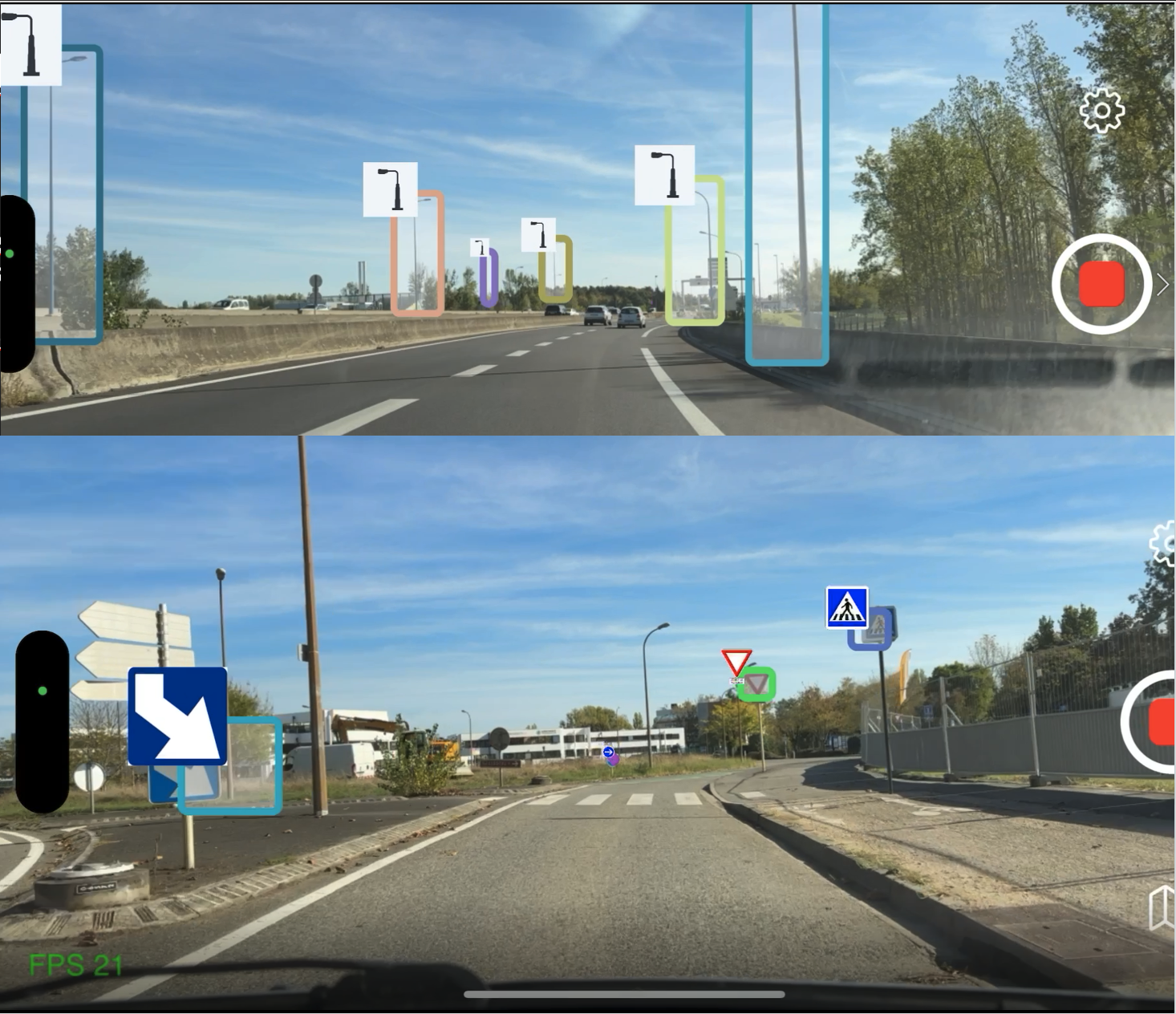
RoadMapper AI – AI-powered field data acquisition
RoadMapper AI is an innovative tool for automatic object recognition based on artificial intelligence and georeferenced video.
Mobile and autonomous, it runs on a smartphone and enables real-time capture, geolocation, and transfer of field data — streamlining data collection and updates. Product overview (french pdf)
Cartographic Machine Learning
With years of experience in Machine Learning, we provide services for extracting information from digital maps.
Here are some recent examples:
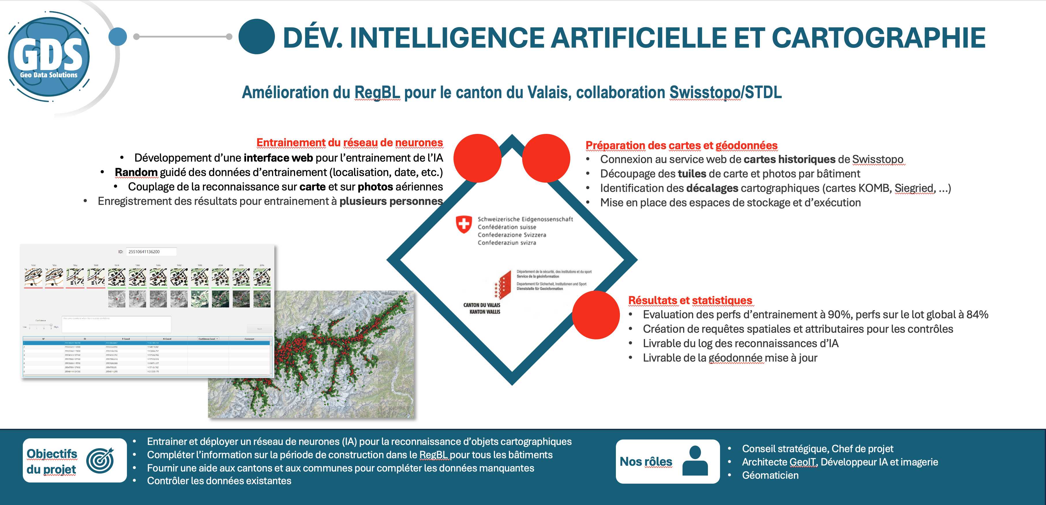
Analyzing historical Swiss national maps dating back to 1940 to determine the construction years of buildings still standing today.
This project aimed to validate a high success rate (90%) across an entire cantonal territory.
It was carried out in collaboration with the Swiss Territory Data Lab
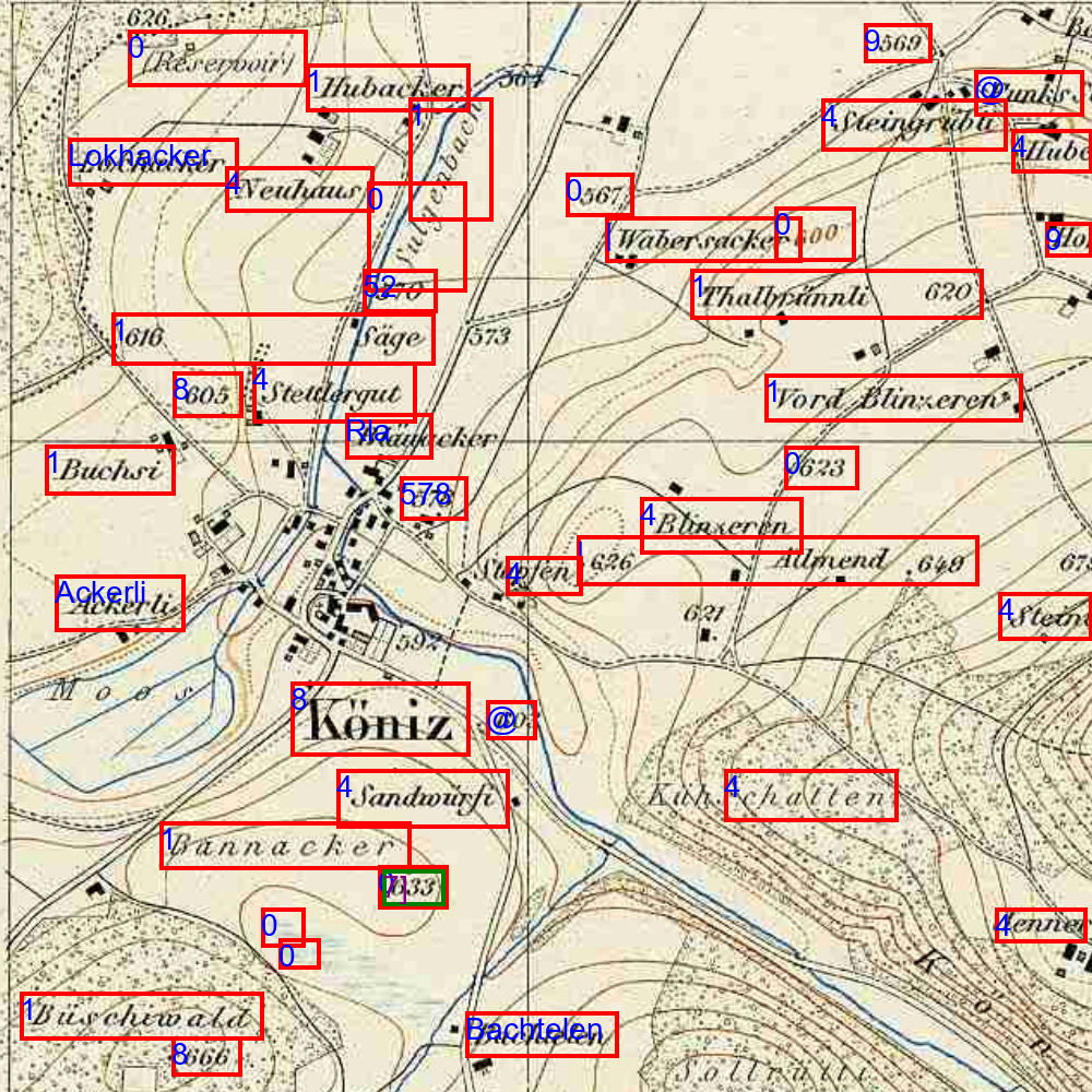
Analyzing historical Swiss maps dating back to 1400 to build a multilingual geolocation system for historical sites.
This system generates an AI-based knowledge database, which is then leveraged by other AI processes to geolocate information related to heritage and history.
AI-Driven Acquisition from Image, Video, and LiDAR Sources
Project for object acquisition and geolocation on public transport networks.
Development of a custom, lightweight, and optimized AI architecture for object recognition from georeferenced videos, complemented by LiDAR data — or inversely, detection within LiDAR point clouds with cross-verification using video footage.
The collected data feeds both a CMMS (Computerized Maintenance Management System) and a GIS (Geographic Information System), enabling synchronized operation between the two systems.
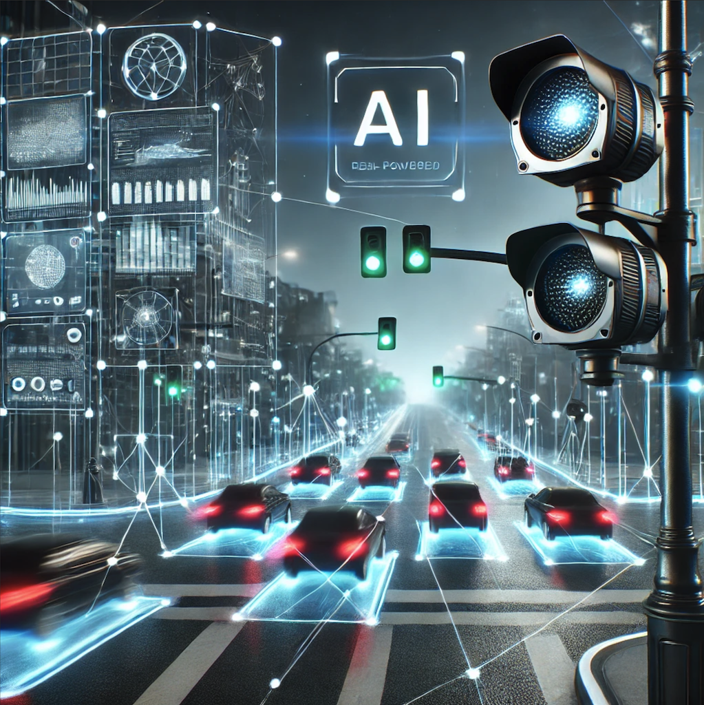
Vehicle Detection — Optical and Infrared
Advanced analysis service for real-time video streams from electro-optical and infrared cameras, dedicated to specific applications in detection, classification, counting, and tracking.
Development in progress — more information coming soon…
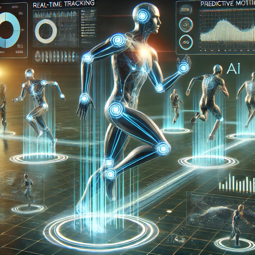
AI and Geolocation for Sports Tracking
Innovative AI solutions for real-time athlete tracking, combining geospatial precision and artificial intelligence.
Tracking, analysis, and prediction are at the core of the project!
Development in progress under NDA and patent application.
More information coming soon!
Generative AI, LLM / SLM — Geocoding — Specialized Analyses
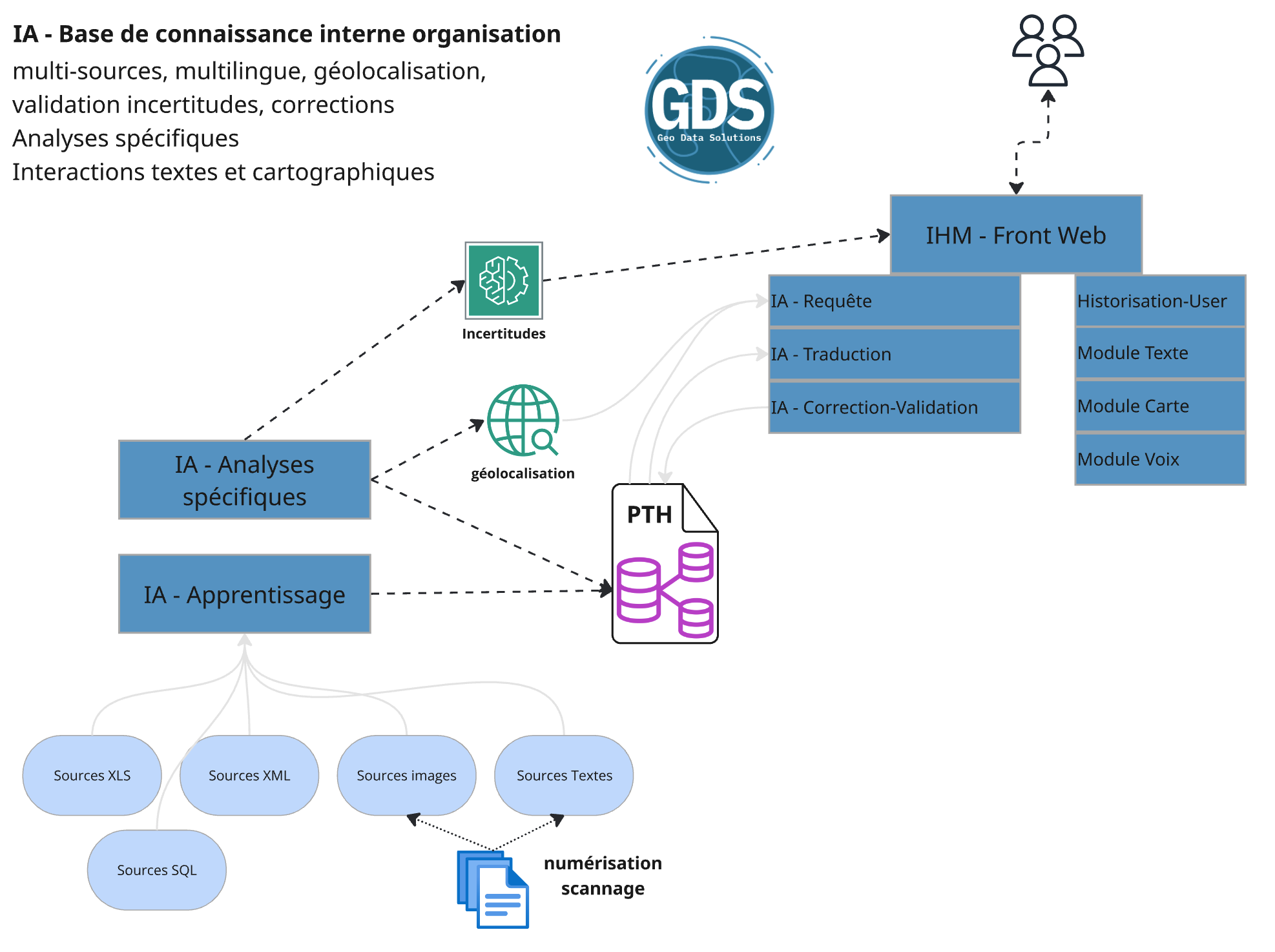
Development of an AI pipeline for learning from heterogeneous, semi-structured information, building a specialized knowledge base, training specific analysis models, correcting and retraining, and geolocating buildings, events, and people.
The exchange interface is multilingual and provides both textual and cartographic responses!
The data sources span over 800 years and are available in various languages (French, German, Italian, English, Latin) and formats (modern texts, ancient writings, images, maps, legends, SQL databases, XML files, Excel spreadsheets).
The territorial coverage includes the entire Swiss territory.
In this project, generating AI model files (.pth) replaces the almost impossible task of designing a fully structured database.
Development in progress under NDA. More information coming soon!
Computer Vision: The Concept of Geo-Augmented Video
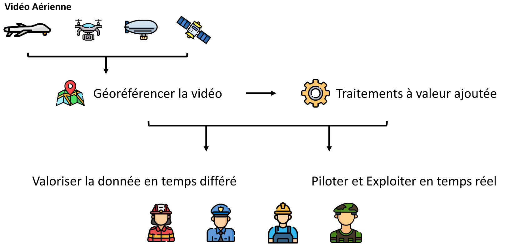
- Use sensor information to locate the video.
- Integrate value-added processing to project, contextualise and augment the video.
- Retrieve metadata, georeference and integrate processing without interrupting the video stream and with minimal latency.
Your video sensors are insufficient to provide the necessary metadata? We advise and provide them if needed!
A few examples of our projects
Geo-augmented video
These developments make it possible to integrate geographical data into the video stream for viewing on the ground or directly in flight.
Objectives:
- Displaying geographical markers to help analyse the videos
- Sharing geo-referenced objectives between tactical situation keeping and video analysis
- Automatically hide geo-defined regions
- etc.
Real-time orthoimages
These developments make it possible to produce orthoimages in real time during the flight and to visualise them right up to the operational stations on the ground.
Objectives:
- Bringing fresh images into the map view as quickly as possible
- Quickly take the measure of a crisis situation (flooding, fire, etc.)
- etc.
Multiple tracking
These developments allow vehicles to be detected and tracked from fixed or mobile cameras.
Objectives:
- Detecting and tracking vehicles
- Measuring speeds
- Detecting intrusions in a defined area
- etc.
Object tracking
These developments allow objects to be detected and tracked in real time or in post-processing.
Objectives:
Hanging a target or visual cue
- Driving optronics to keep a target in the field
- Flying a drone to track a target autonomously
Body Tracking
These developments enable the precise detection and tracking of individuals, either in real time or through post-processing.
Objectives:
-
Detect individuals and react according to specific contexts
-
People counting
-
Detection of specific movements (e.g., falls)
-
Blurring for privacy protection
-
Trajectory tracking
